
Here’s a must-read trekker’s guide to hiking in Tajikistan, including a list of 6 stunning hiking trails. Whether you want to join a trekking company or hike independently, this guide covers everything you need to know about trekking in Tajikistan.
Tajikistan’s rugged and mighty landscapes offer unparalleled mountain adventures. Exploring this enchanting country on foot is one of the most intimate ways to get to know it.
What made me fall in love with Tajikistan was its variation in terrain and scenery. While not many hiking trials are established in this magnificent country, there are hundreds of pathways carved out by local shepherds and villages.
You can walk up Martian-like summits in the Pamir Mountains, swim in teal-tinted alpine lakes in the Jizeu valley and camp beneath the jagged peaks of the Fann Mountains.
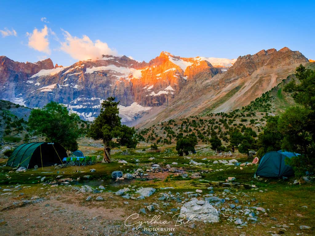
Tajikistan is the third most mountainous country in the world and has several mountain ranges, but the two main stretches are called the Pamir Mountains and Alay Mountains.
The majority of hiking trials which are accessible to visitors are situated in the Pamir Mountains and the Fann Mountains.
Hiking in Tajikistan isn’t just about exploring breathtaking scenery. Each province is home to lively little villages with locals who generously welcome you into their homes and share their way of life. There’s also rare wildlife and geology to seek out in your trip.
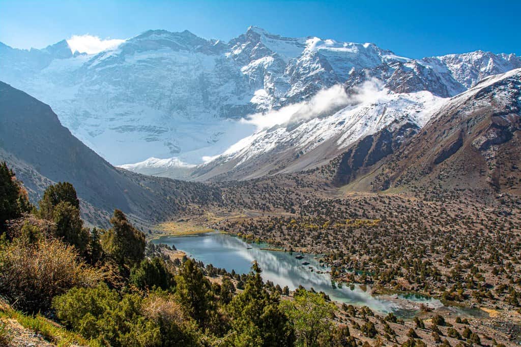
The majority of hiking trials accessible to visitors are situated in the Fann Mountains.
In this guide to hiking in Tajikistan, we cover everything you need to know whether you want to organize a trek with a company or hike independently around the country. It also includes a list of some of the stunning day hikes and multi-day treks the mountains offer!
Tip: See my Tajikistan Travel Page for a complete overview of all my travel guides and blog posts about Tajikistan!
Embark on the adventure of a lifetime: join the Pamir Highway Adventure Tour or explore the Highlights of Tajikistan, including the Jisue and Wakhan Valleys and the stunning Fann Mountains!

Disclaimer: This posts might contain affiliate links, meaning that if you make a purchase through these links, I may earn an affiliate commission. Thank you for helping to support this website!
Plan your trip to Tajikistan
Traveling through Tajikistan requires a bit more preparation than your average trip. These are the tools, guides, and services I personally recommend to make your journey smoother, safer, and more comfortable:
- ✈️ Find the cheapest flights → Check fares to Dushanbe
- 🥾 Bring proper travel gear → Mountain weather in Tajikistan can change very quickly
- 📱 Stay connected with an eSIM → Useful in cities and along parts of the Pamir Highway (use code CYNTHIA to receive 15% off)
- 🏨 Find hotels and guesthouses → From boutique stays in Dushanbe to family-run homestays in the Pamirs
- 🛡️ Get good travel insurance → Essential for hiking, mountain travel, and high-altitude adventures
Helpful Tajikistan travel guides
- → Tajikistan Safety Guide
- → How to Travel the Pamir Highway
- → Hiking in Tajikistan
- → Best Places to Visit in the Fann Mountains
- → Dushanbe City Guide
- → What to eat in Tajikistan
Explore Tajikistan with me
Looking for a deeper and more comfortable way to experience Tajikistan? Join one of my small-group adventure tours or let me help you plan your own unforgettable journey.
1) Hiking in Tajikistan in 2025 – Entry Requirements for Tajikistan
1.1 Visa requirements
It depends on what country you’re travelling from, but residents from more than 80 countries including all EU member states, the US and Australia are eligible for visa-free entry for 10 days. Caravanistan has a lot of helpful information here.
If you are staying more than 10 days, you will need to register at the OVIR office, at either Khorog or Dushanbe. A travel company such as our partners Visit Alay can help you with this.
Other countries, such as the UK, are exceptions to this. You can apply for a 45-day visa through the e-visa service, which has the GBAO permit (read below) included. You won’t need to register through the OVIR service.
Get your e-visa sorted in plenty of time before your trip. I am from the UK and went through this e-visa service but I was rejected the first time. I had to pay an extra $50 fee and get a letter of invitation from our partner, Visit Alay, before I was granted it.
1.2 Permits
A good deal of the Pamir peaks are in the Gorno-Badakhshan Autonomous Oblast (GBAO) district, a province in eastern Tajikistan. You likely want to travel here if you’re wanting to explore some of Tajikistan’s most breathtaking scenery.
As a security measure because of the neighbouring border with Afghanistan, a GBAO permit is needed and you can apply for one here. You may also need a letter of invitation which can be obtained from a travel company.

You will need a GBAO permit if you’re heading to eastern Tajikistan
If you’re looking to head to the Tajik National Park or Lake Sarez you will need to buy a permit for each day. Pamir Eco Tourism and Pamir Trail can assist with this.
No permits are needed for the Fann Mountains, but you do need to pay a small daily fee to the forest ranger at Alauddin Lake and by one of the camps by the smaller lakes near Kulikalon, according to Talakai.org.
2) How to travel to hiking trails in Tajikistan
2.1 By car
While you can travel across the Pamir Highway via marshrutka, getting to trail heads without a 4WD car is really difficult. The bumpy and unpredictable tracks are merciless on vehicles and the mountains are extremely remote.
Even if you have 4×4 experience, I would not recommend renting a car in Tajikistan. I saw dozens of abandoned, hollowed-out shells of cars on many of Tajikistan’s roads. I’d only recommend it if you were taking your own 4WD (which you knew intimately and could fix!) and you have previous experience driving in Central Asia.
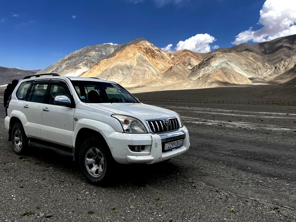
Tajikistan’s roads require another level of skill to drive!
But just as a note, Tajikistan requires another level of skill to general driving in Central Asia. It’s notoriously hard to navigate, with river crossings, possible mudslides and unforeseen car issues.
A great way to get to the trail heads you want to do is buying the services of a a driver. With companies like Visit Alay, you can tailor your trip with ease.
2.2 Independently
If you’re craving to do something independently, there’s a really impressive long-distance backpacking route called the Pamir Trail, traversing east to west through some spectacular mountain ranges.
You do need a high level of fitness and some basic level of mountaineering experience to do this, as you may have to walk over glaciers, have a good understanding of avalanche dangers and rockfall.
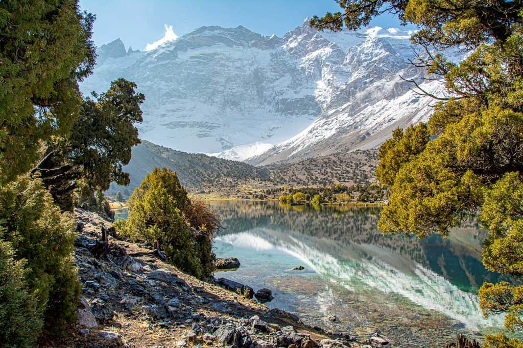
The Pamir Trail starts in the Fann Mountains
2.3 By tour
If you want a fuss-free and fully catered trip exploring some of the best of Tajikistan’s peaks, we offer a 17-day adventure tour of the Fann Mountains and Pamir Highway and an 11-day Pamir Highway Tour.
Together with a small group, you’ll travel to remote mountainous destinations in Tajikistan that are otherwise hard to reach without an experienced local guide and you’ll stay with local families. The driving days are interspersed with day hikes which include the wondrous Jizeu and Wakhan Valleys.
Embark on the adventure of a lifetime: join the Pamir Highway Adventure Tour or explore the Highlights of Tajikistan, including the Jisue and Wakhan Valleys and the stunning Fann Mountains!
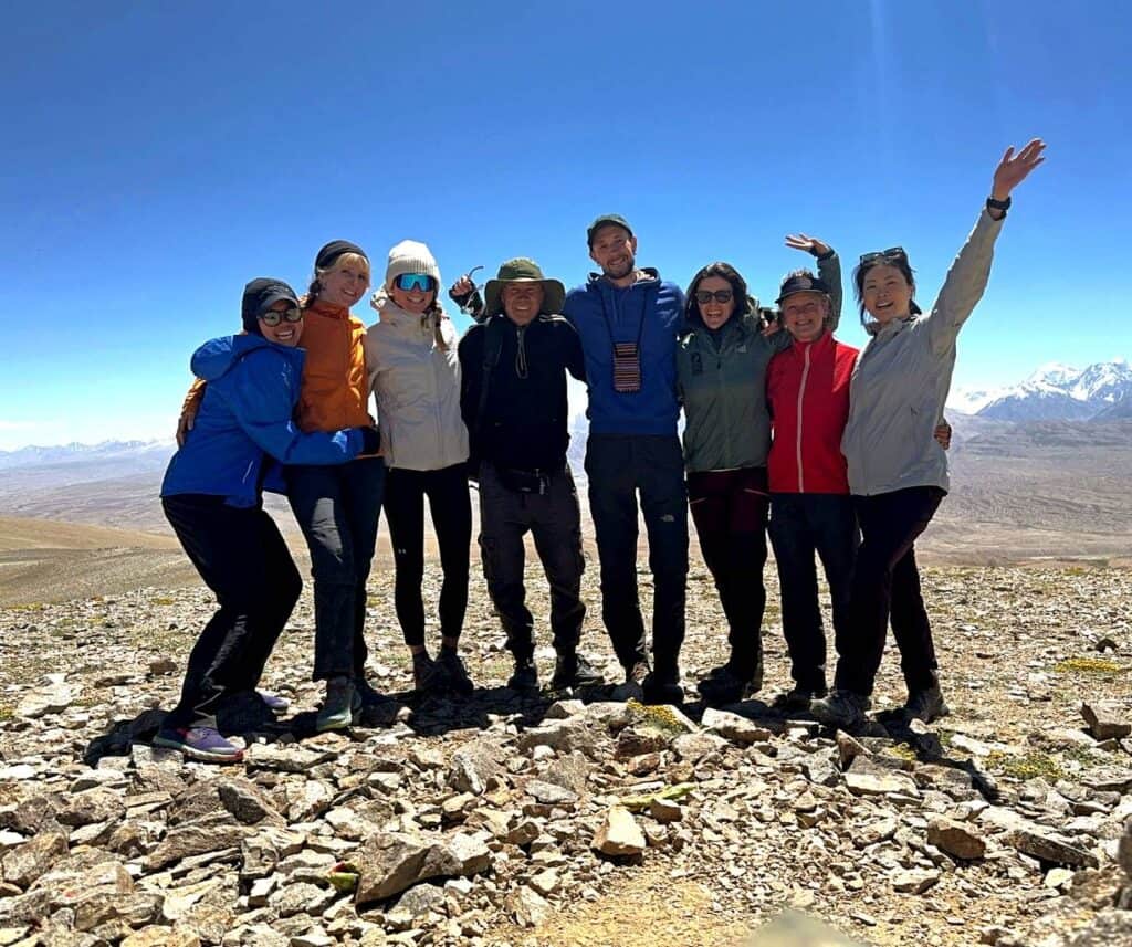
Our lovely group in the 17-day adventure tour of Tajikistan
2.4 By public transport
Shared taxis run frequently in Tajikistan and it is possible to get to some mountain villages.
For the Fann Mountains, there are shared taxis running from Dushanbe, through the Fann Mountains to Panjakent (near the border of Uzbekistan). Caravanistan has a useful forum here.
If you’d like to head to a trail along the Pamir Highway, many of the marshrutkas in these remote areas are 4WD vehicles instead of small buses.
From what I was told by locals, there are several marshrutkas leaving Dushanbe each morning to Khorog. A post on travel forum Caravanistan has said that this takes about 12 hours.
From Khorog to Iskashim, there are regular 4WDs available. From Iskashim, there is only one marshrutka per day, but hitchhiking is common out there. Agree your price and destination before departing. There are public 4WDs also from Khorog to Murghab, but not via the route of Langar in the Wakhan Valley, according to a post on Caravanistan.
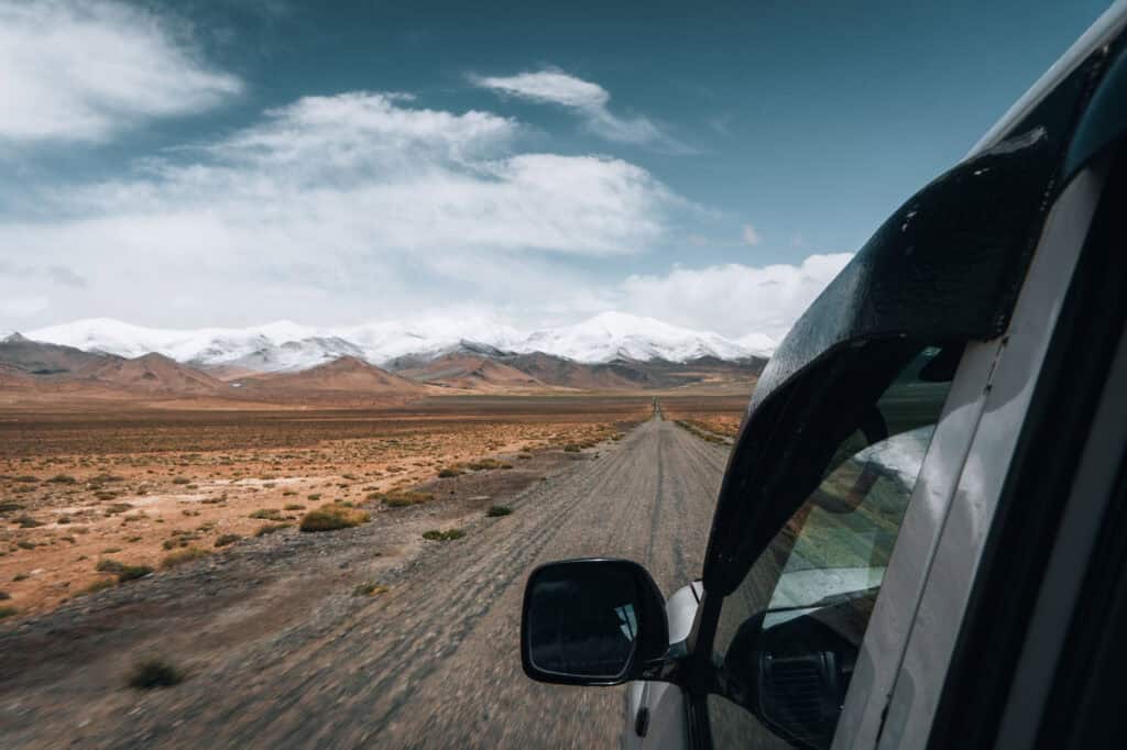
Something to bear in mind is that trails along the Pamir Highway won’t be a contained mountain range, so you’ll have to figure out your next mode of transport once your hike is finished.
The marshrutkas are incredibly cheap but be prepared to wait longer – I was told by our guide that they can get full quickly and you’ll need to anticipate adding on extra days if there is no room. Many locals need to use them for business or visiting their families, so you may want to give them priority.
3) Do I need a guide to go hiking in Tajikistan?
If you were heading somewhere in the Fann Mountains which sees more footfall than say somewhere remote in the Pamirs, I wouldn’t necessarily say you would need a guide.
The paths are more obvious in the Fann mountains, it’s easier to set up camp and find water. Therefore it’s easier to hike independently. It’s also lower in elevation and although there are still obvious mountain dangers, you’re less likely to get altitude sickness.
Unless you have appropriate mountaineering experience, I’d strongly advise buying the services of a guide or buying through a company.
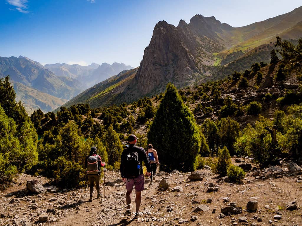
A guide can help you to navigate the tricky terrain
On a practical level, the guides are so skilled in driving on the rough tracks and they know hiking start points and villages intimately. They also have great recommendations from places to eat and yurt camps to stay at.
From an ethical view, Tajikistan is one of the poorest countries in Asia and buying the services of a local guide is a positive way to help out the tourism there.
Our guides Kanybek and Talant went above and beyond to share their culture, food and traditions with us which made our trip so special.
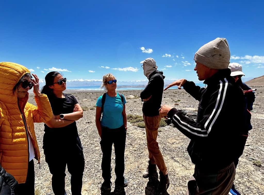
Our guide, Kanybek, was so eager to show us so much of his country
On our trip, we met some of the guides’ families which was a highlight for many of the group. They shared their Tajikistan with us and I really felt I got to know the country. Do plenty of research and think carefully about which organization you go with.
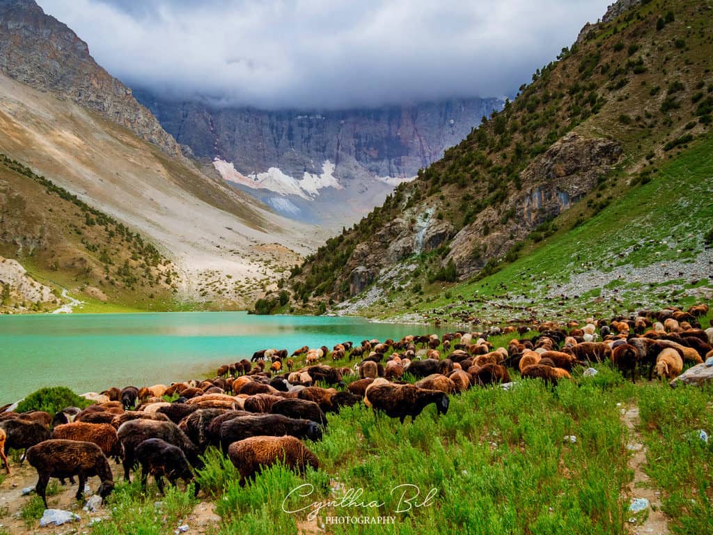
Something that Journal of Nomads really champions is Community Based Tourism (CBT). CBT employs local people and their services, training them up and offering reliable employment in aims to alleviate poverty.
Our partner is an organization that reinforces the CTB initiative in all of its work. The group invests in the infrastructure of locals’ yurt camps and it says about 300 local Kyrgyz and Tajik people were involved in tourism during summer.
4) When is the best time of year to go hiking in Tajikistan?
Plan your trip from June to early October – there are multiple reasons for this.
Given that 93% of Tajikistan is mountainous, there is a huge avalanche risk in late winter and early spring. The snow, especially in the higher altitudes in the Pamirs, will likely still be there into July. Snow starts to fall usually in early September.
When the snow starts to melt in spring, it rushes down into the mountain villages, causing mudslides. Tajikistan is seeing the very real impacts of climate change, which is causing heavier rainfall and shorter winters.
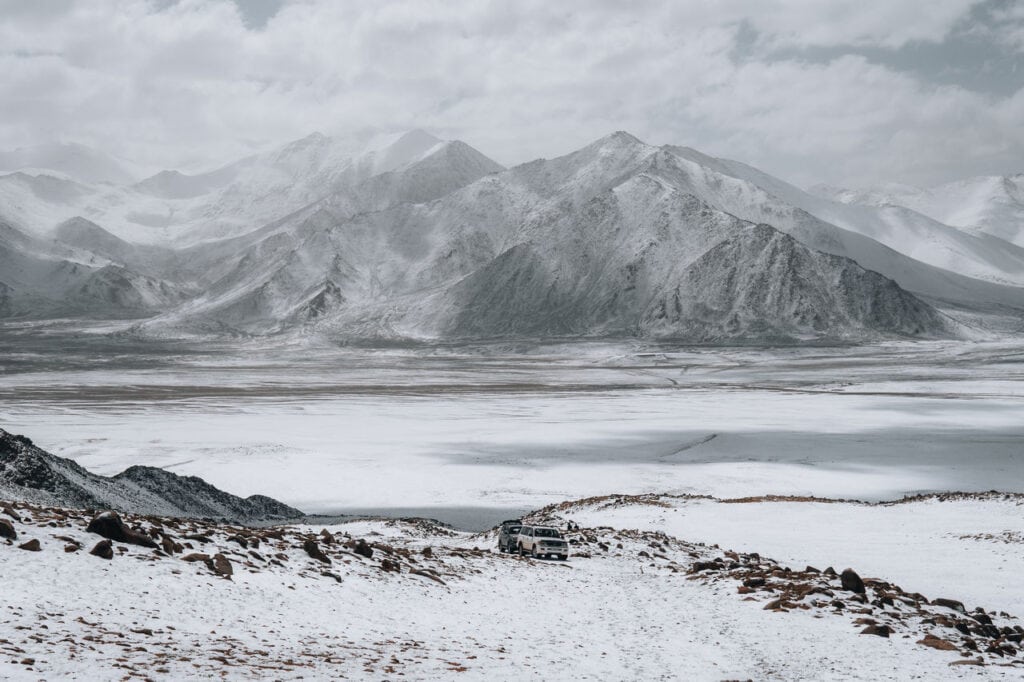
Snow can fall on the Pamir Highway from late August
Mudslides and landslides are pretty common, especially along the Pamir Highway. They can cause devastating results in the community.
When it comes to your trip, there is less chance of landslides during summer months, but they can still happen. If there is rain predicted, consult locals before driving on track roads near peaks.
Another logistical reason is that it is far harder to travel as a tourist in remote Tajikistan during late autumn/winter/spring.
Many drivers only operate from late May to early October and tourist guesthouses will be hard to also access outside of these times.
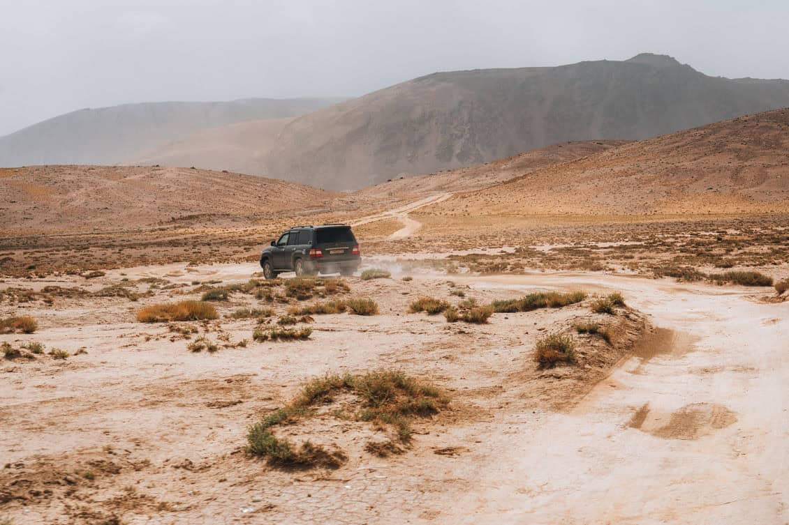
The best time to go hiking in Tajikistan is from early July to early October
5) What you need to know before you go hiking in Tajikistan
Here are some tips and tricks I learned in my time travelling in Central Asia!
Bread is sacred in Islam. When at guesthouses in Central Asia, it’s so important not to waste bread or leave large chunks of it uneaten on your plate. A guide once told me about some tourists that once flushed bread down a toilet in a homestay which deeply offended the owner.
Take off your shoes before entering homes. This is a fundamental part of respect in Islam and you must remove shoes before entering yurt camps and homes.

Food cooked at homestays will depend on seasonal produce
Veggie/vegan meals. You will likely eat with many Tajik people who will welcome you into their homes. Providing meat at dinner is a huge sign of honour to you, the guest. It was possible in most Pamiri homestays to ask for dinner without meat, but broth etc was obviously still cooked with meat residue. Vegetable selection depends on seasonal produce. Many Tajik families are working farmers, so slaughtering and preparing livestock is part of their daily life.
If you are squeamish about animal slaughter or have a strong moral opposition to the consumption of animals, you may have to rethink your trip.
Download Tajik and Russian on Google Translate. This was so helpful. You can download the two languages offline and then use it as a basic form of communication in homestays. If you have space on your phone, I’d also download Kyrgyz. In Murghab, people are predominately from Kyrgyzstan.
Rubbish. Tajikistan does not have advanced waste disposal systems. In the mountain villages, waste is often tipped into a large pit or thrown off the side of a hill. Please, please, please do not litter and help out the Tajik people. We did see some Western litter in the mountains which we, as a group, picked up. I would take plenty of small strong plastic bags to hold your waste.
Poo etiquette. Something I found a bit alarming was there was some crappy bog paper littered on the more popular hiking trails. I can confidently say that this was from foreign tourists and it’s really not cool that this is the way they have quite literally left their mark in Tajikistan. If you need a nature poop, it’s no problem. Move at least 50m from waterways and streams, dig a hole, bury it and then take your loo roll away with you. Please don’t litter this beautiful country! For more info, read TOILET TIPS FOR HIKING IN TAJIKISTAN.
Don’t flush loo roll! Sorry, another toilet tip but it’s really important. Tajikistan’s toilet systems are not strong enough to swallow loo roll. There are always bins beside the toilet to dispose of used loo roll. If you do flush loo roll, you’ll find it won’t properly work and it will often block the toilet – causing a nightmare for you and a lot of people.
Print out several copies of your visa and passport. There are many checkpoints on the Pamir Highway which need print-outs of your details in order to pass. If you need more information about the checkpoints because you are travelling independently, contact Visit Alay who can help with this. Never hand give out your passport to anyone. If a police officer asks to see your real passport, tell him to take you to the station to see the chief of police.
Download maps. Even if you’re being guided, it’s really important to download offline sections of Tajikistan so you can plot start and end points. I tend to use Gaia GPS but another popular app is Komoot.
Greet people with hand on heart. A gracious way to say hello to Tajik people is by slightly bowing your head and placing your right hand on your heart. The main greeting is “As-salaam Alaykum” which means “peace be upon you”.
Ramadan. Think about booking your trip outside of Ramadan dates. It will be harder to access food during the religious holiday… and guides will be more tired!
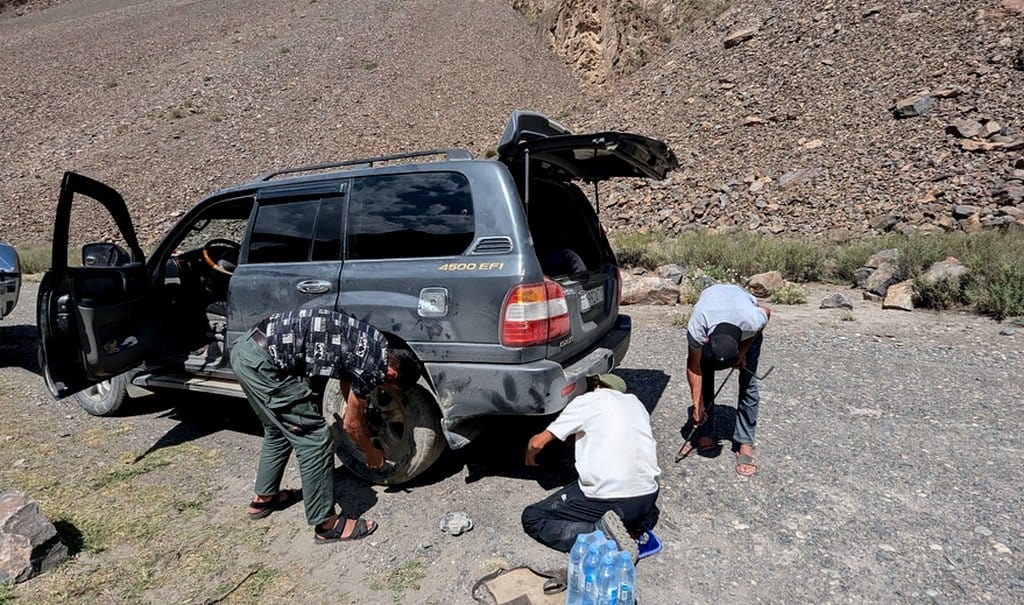
Not everything will go to plan… embrace it!
Know your ability. Tajikistan isn’t the place to really push yourself if you don’t know your limit. The altitude will dial everything up significantly and if you need to sit a hike out and rest for the day, do it. Cliche, but the mountains will always be there. Tajikistan’s landscapes are captivating… so learn to find peace in stillness. This especially counts if you suddenly get struck by illness, which is common!
Don’t accept rubies. You may be sold rubies in the remote parts of Tajikistan. Don’t accept them. It is illegal to buy rubies in Tajikistan and you could get in a lot of trouble for it.
Unforseen hiccups! This is an adventure trip and not everything will go to plan… embrace it! In the weeks I was travelling the Pamir Highway, we all had a violent stomach bug, a mudslide blocked a main road in Langar, the car broke down and someone left their wallet in a remote village. Things will happen beyond your control but your reaction is within your control.
Further note to the mudslides, they do happen in the mountainous parts when the sun heats up the glaciers, which in turn melt into the valleys, or during rainfall. They tend to happen in the afternoons. Our drivers were incredibly knowledgeable about when they’re due to happen, they mitigated the risks and provided a plan B. We had a mudslide happen just outside of Langar -thankfully no one was injured and no infrastructure was hit. Authorities immediately came to help the community and the road was open again within two days.
6) What wildlife can I see hiking in Tajikistan?
There is plentiful rare wildlife for you to keep your eyes peeled for while hiking. Definitely bring some binoculars!
Prowling among the peaks in the Murghab province (GBAO district), there are snow leopards! Snow leopards are some of the world’s most elusive creatures and sadly they are an endangered species.
Roaming at high altitude, they are found in cliffs, rocky outcrops, and ravines but their camouflaged coat makes them even more tricky to spot.
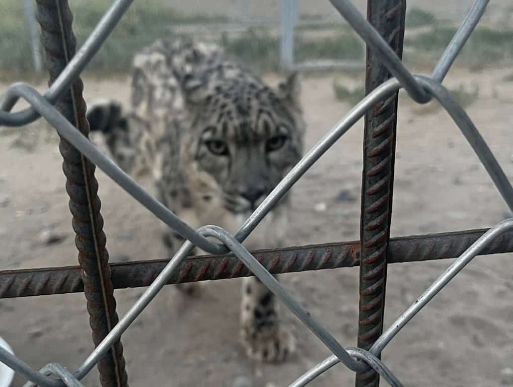
Tajikistan has recently opened its first snow leopard reserve
Tajikistan’s government has recently built its first ever snow leopard reserve just out of Murghab. The conservation project involves rescuing young abandoned cubs and rearing them, before releasing them back into the rugged mountains.
Other animals at home in the Pamirs’ rocky outcrops include the spiral-horned Siberian ibex and Marco Polo sheep. On our hike to Engels Peak, we spotted a cheeky Altai weasel peeping from behind the boulders.
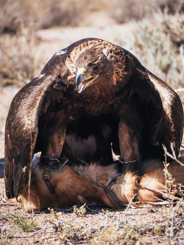
Keep your eyes up in the skies too – you’ll soon see birds of prey including hawks, golden eagles, goshawk circle above you.
7) Are there any dangerous animals in Tajikistan?
There are records of brown bears living in the mountains but when I talked to the guides they did not know of any sightings. The highest density of brown bears – according to wildlife sites – live in the Hissar-Alay mountains but they are shy and from what I’ve been told, not as aggressive as US grizzlies.
It goes without saying, but if you’re hiking in this range it’s a good idea to make lots of noise while walking and plan your camps carefully. I’ve not heard anything about bear attacks on people in Tajikistan – they’re much more common on livestock – but it’s better to be safe.
There are four venomous snakes found in Tajikistan – the Halys pit viper, the saw-scaled viper, the Levantine viper and the Central Asian pit viper. All of them are pretty venomous and you don’t really want to get bitten by these.
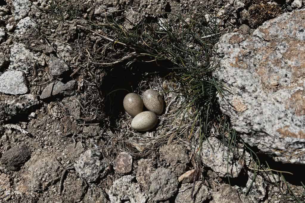
These vipers are found in rocky foothills, shrublands and some in forested areas. They are not aggressive and will only defend if provoked (or stood on!) so if you go off path it’s something to bear in mind.
There are wolves in the mountains, but again, they are not aggressive and they tend to keep away from humans.
The most likely dangerous animal you will come across are the shepherds’ dogs. An integral part of Central Asian farming is transhumance shepherding and having dogs are crucial in protecting their flock from unwanted visitors.
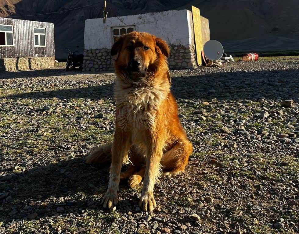
Shepherd dogs actually have a super placid temperament… once the shepherd gives the all clear!
Under the command of a good shepherd, the dog will be obedient and not bother you. However, I’ve had it happen where the shepherd has been elsewhere (or asleep!) and a pack of snarling dogs surrounded us… it was pretty scary! I’ve not read about any dog attacks in Tajikistan but when they defend their territory it can get hairy.
If it happens, stand tall, look the dogs in the eye and back away slowly. If they continue to be aggressive and you can’t safely retreat, grab rocks and throw them at the dogs – it’s a technique used by shepherds.
To avoid this situation, if you approach pastures and you hear dogs barking, stop and wait. Assess whether you can see their shepherd nearby and if not, consider a different approach. The ironic thing is that once the shepherd gives the all clear, they become fluffy teddy bears wanting a cuddle!
8) How to plot hiking routes in Tajikistan
I have searched high and low for large-scale maps of the mountain ranges in Tajikistan but I am at a loose end. *If you’re reading this and have access to a map, please get in touch, we’d really appreciate it!*
While I was out there, I used Gaia maps, which had a very basic terrain overlay and the occasional track. It was useful when getting to a rough waypoint using the GPS satellite function, but do not rely solely on this for navigation.
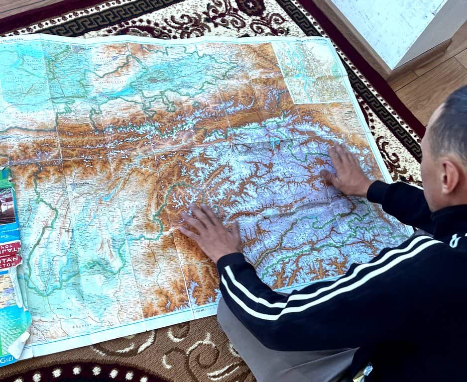
Always plot your routes, even if you’re being guided
Another app that I saw some people using was Komoot. For exactly the same reasons as above, you need to be careful using it. I’ve heard really positive things about Mapy.cz, but I haven’t had chance to use it yet. I’d have at least two navigation apps which you can comfortably use and that you have downloaded the maps for.
Even if you’re being guided, always ask for a few waypoints to input on your navigation app. It’s so important if anything were to happen (not trying to scare you, just for general reasons for being in the mountains) that you can get to a point of safety.
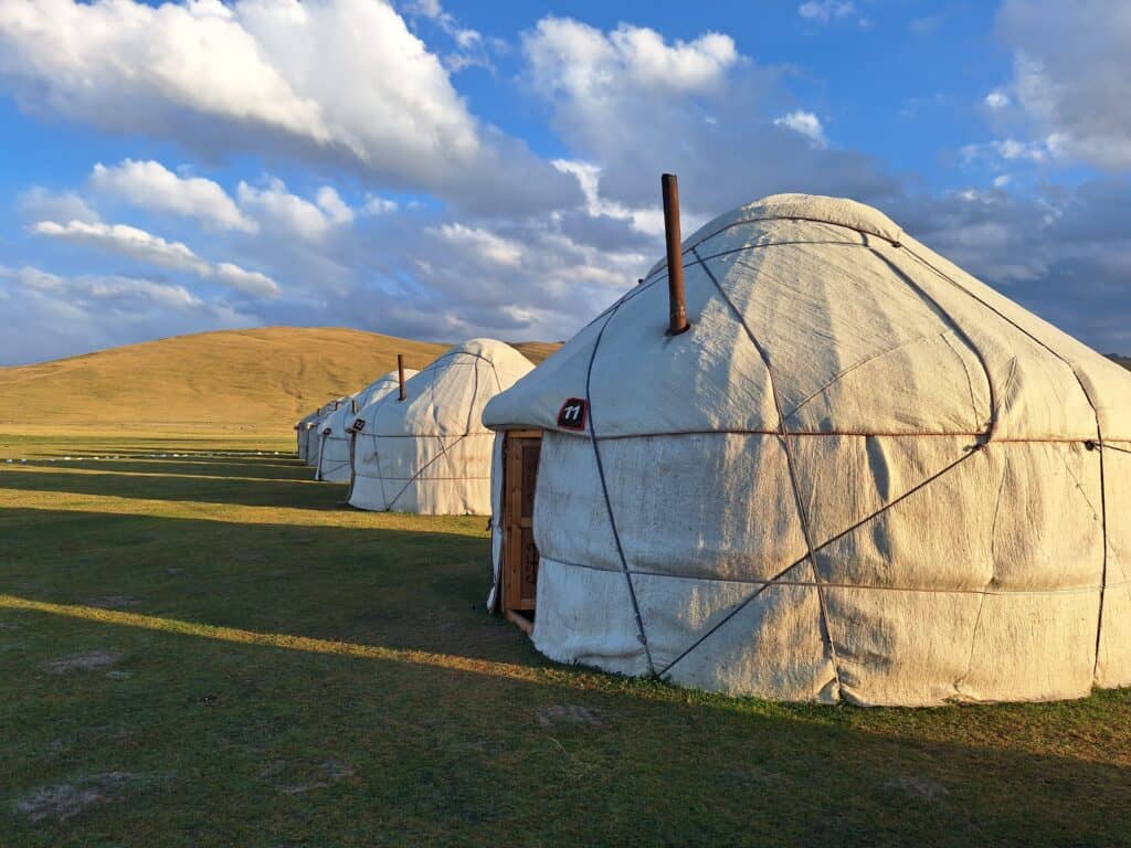
9) How to find accomodation for hiking in Tajikistan
9.1 Yurt camps
Yurt camps are traditionally built by nomadic families and are set up in remote and wild places. The tents alone are magnificent with Kyrgyz felts and Tajik decorations hanging inside.
Yurt camps often offer jaw-dropping nights of stargazing and a peaceful place of rest. There are some beautiful yurt camps in Tajikistan, especially in the Murghab district, where a lot of Kyrgyz people live.
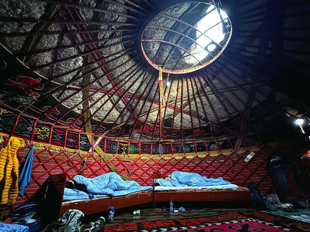
Yurt camps can get busy in the height of summer season and they’re often located in incredibly remote places, so while you can totally show up on the day and ask for space, it could be a risk if you’re relying on a bed and food!
It could be worth checking in with a CBT group before your trip and ask if they have any contacts where you can check.
9.2 Guesthouses and homestays
Many Central Asian families living in the mountains graciously offer up their homes as guesthouses to visitors. It’s a window into the Tajik culture and household, who welcome you to learn about their traditions while hanging out with the family for dinner.
At the guesthouses you can get freshly-cooked food, a bed (or a thick roll-out mat called a kurpatcha), a *sometimes* hot shower and Wi-Fi. You don’t need to book, you just turn up in the afternoon.
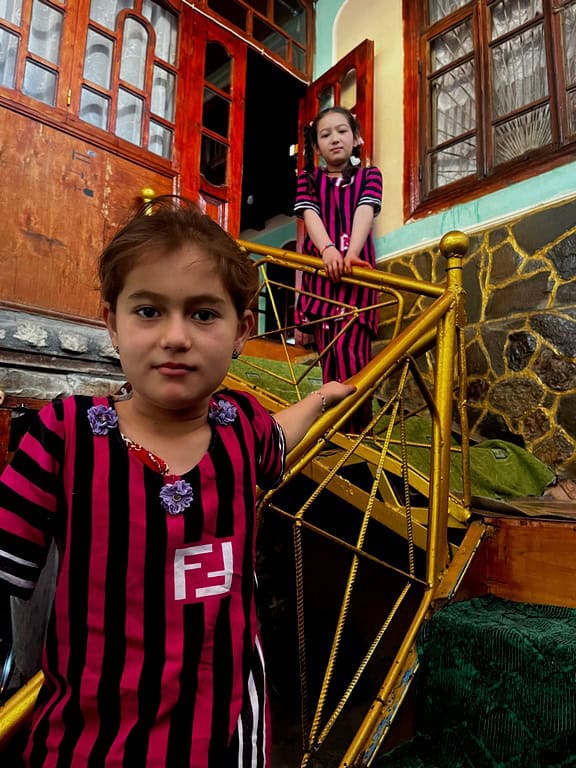
Amina and Yosuman wanted me to dance with them before dinner!
If a guesthouse is full, the owner will likely kindly help you find accommodation elsewhere. Even if the owners refuse to accept pay for the stay and food, please do pay them. At the time of writing, around $20-$25 per night is a fair amount for accommodation, dinner and breakfast.
9.3 What are the facilities like in yurt camps and guesthouses?
Go into this with an open mind and don’t expect anything… you’ll then find you appreciate everything so much more! What I usually see is that with people who’ve never experienced Central Asian traditions but are ready to take on anything with a smile have the most rewarding trips.
Some places have showers, some don’t. Some have fully flushing toilets, some are holes in the ground. There are many stunning lakes in the mountains you can refresh yourself in but you can also embrace being at one with nature 😉
Most places, even yurt camps, have some kind of electricity output nowadays. Tajikistan’s plugs are Type C (the same as European plus). Always bring a power bank just in case though!
For information about Wi-Fi and internet access, scroll down to HOW IS THE INTERNET IN TAJIKISTAN?
9.4 Camping
Camping is easier in the Fann Mountains compared to somewhere like the Pamirs, mainly because you’ll find more water sources and greener places to set up camp.
It’s also worth noting that you do need to be careful about selecting camp spots where transhumance shepherding happens because their dogs can be pretty terratorital (read more in ARE THERE ANY DANGEROUS ANIMALS IN TAJIKISTAN?).
If you’re doing something like the Pamir Trail, consider a free-standing tent because of the dusty, barren and rocky terrain.
Something I sadly need to nag about is toilet hygiene and camping etiquette. Tajikistan already struggles with waste due to lack of advanced waste disposal systems. When out in the Fann Mountains, I did see a fair bit of litter and toilet roll scattered by trails.
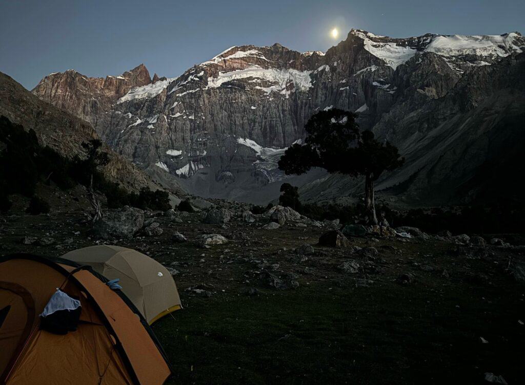
You’ll often get moonlit skies which make for five-star camp spots
Most of the litter seemed to come from western shops and Central Asian people don’t tend to use toilet roll – so it tells you everything you need to know. Please don’t plague this stunning country with trash… leave no trace and take everything with you!
If you are wanting some tips and tricks for back-country bidets and toilet hygiene, read on to TOILET TIPS FOR HIKING IN TAJIKISTAN.

10) How is the internet in Tajikistan?
Pretty obvious answer but when you are in the mountains, the signal is slim to none.
When I was in Dushanbe, I picked up a pre-paid MegaFon sim card ($5 for unlimited data for a month) which worked great in most villages. I was told T-cell is also a good provider.
While Wi-Fi is scarce in the mountain villages, some guesthouse hosts will kindly hotspot you. I found that often in some of the villages, I was able to get signal with MegaFon.
If you’re venturing off solo, consider investing in a GPS satellite device. I borrowed my partner’s Garmin mini. While it was great for sending texts, it is eye-wateringly expensive to maintain. The device itself is not cheap and it cost me about $100 to use it for the month.
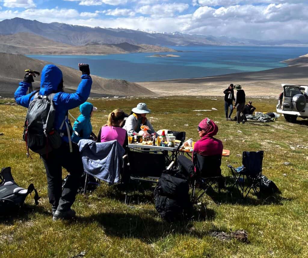
You’ll often go days without phone signal hiking in Tajikistan
11) Toilet tips for hiking in Tajikistan
Oh yes, one of my favourites to get stuck into. Even if you’re just doing day hikes, you never know when you’ll get caught short so it’s well worth having a read!
If you need to go, ensure you’re at least 50 meters away from water sources. Dig a small hole, do your business, bury it and if you can, place a small stick (like a flag) to warn other hikers from digging your dirt up!
Some people bury their toilet paper with the poop, which isn’t great but sometimes, needs must. Some people burn their loo roll but *try NOT to do this*… causing a wildfire shouldn’t be on your anything to declare flight form.
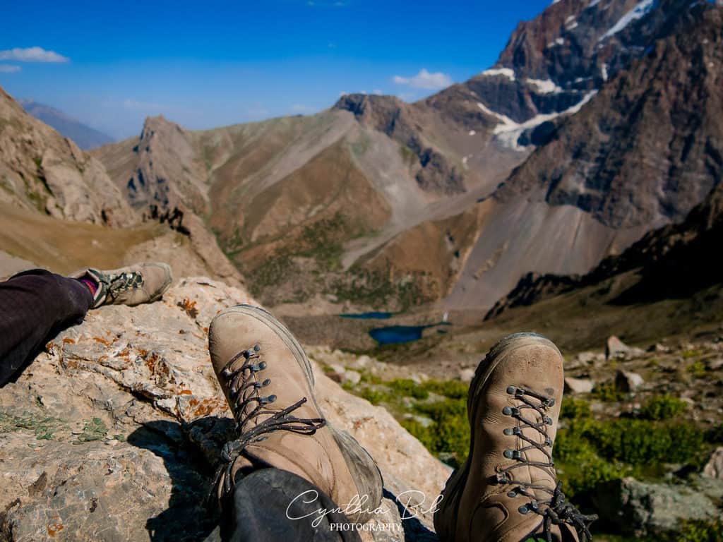
You’ll often have to go without a toilet while hiking in Tajikistan
Others take their used loo roll with them but this obviously can cause hygiene difficulties if you’re out for long periods of time.
The gold standard is creating your own bidet with a water bottle. You can even buy a small bidet cap (weighing nothing!) that you can bob onto the bottle and in seconds, you have a clean bum and no waste.
For pee-pees, there are antimicrobial cloths that essentially work as a piss rag. I sometimes use a Kula cloth which you can hang to dry on your backpack. If you’re on a budget, use a bandana!

12) What to pack for a hiking trip in Tajikistan
12.1 Clothing and gear
- Binoculars. There is plentiful rare wildlife to spot in Tajikistan’s mountains. A lightweight pair of binoculars are a great to bring with you.
- Kula cloth / bandana. Really helpful for pee-pees in the wild and environmentally friendly.
- Hand-held bidet. Amazing little device for a clean bum and weighs next to nothing. Also a really hygienic way in-keeping with leave no trace outdoor ethics.
- Trail runners/walking boots. I took both trail runners and stiff mountaineering boots on my trip to Tajikistan in early August. The boots were left in the bottom of my bag. In August, trail runners are usually great for everything you need for a hiking trip. However, it’s really important that you gather some detail about weather conditions just before your trip as some of the mountain trails may have snow (in the months up until late June and after late August) so boots could be a better option.
- Head torch. Many toilets in the homestays and yurt camps are outside so you’ll need this to get about!
- Water filter. This should be high up on your list. While you can buy lots of bottled water in shops, if you go off into the mountains you never know when you’ll need water. I use a filter like this Sawyer one which fixes onto a lightweight water bladder.
- Hiking poles. They’re basically an extra pair of legs to keep you steady ascending and descending – and they’re great for keeping rhythm when walking. Poles are also useful for stream crossings.
- Battery power bank. While most homestays and (some yurt camps!) have Type C plugs, your days will be very long and you will need this item in your day pack.
- Loose long sleeve top and t-shirt. Even if it’s a cooler day, the sun’s rays are so strong. Merino wool blend base layers are really good for wicking sweat – same with a thin wool sock.
- Buff. So useful and weighs next to nothing! You can use it as a hairband, sun cap, bandana, emergency tourniquet… the list goes on. It’s particularly good as a shield for your nose and mouth when the roads become very dusty.
- Wide-brimmed hat. The sun is incredibly hot and often there aren’t places of shelter. It’s good to have a hat that covers your neck and keeps the sun out of your face.
- European plug adapter. Tajikistan has type C plugs.
- Clean flipflops. In homestays and yurts, you must remove your shoes before entering. I had a clean pair of plastic Birkenstocks which I wore inside and for showers etc. They were also useful at the end of the trip while camping.
- Down/synthetic insulated jacket. While it will likely be very hot during the day, temperatures quickly fall in the evening. You’ll need this if hiking high up in the mountain ranges.
- Waterproofs. Always keep a jacket on you because storms can quickly sweep over.
- Sleeping bag. Even if you’re not camping, I’d really recommend bringing a sleeping bag because nights in yurt camps can be a little chilly without one.
- Blow-up pillow. Again, really useful for yurt camps and adds 60g of luxury. Also can be used to prop your head up if you need a nap while travelling in cars etc.
- Micro spikes/crampons/ice axe. If you’re going solo, you’ll need to pack these and be able to confidently use them. If you’re going as part of a tour, the leaders will be able to specify what to bring.

16.2 Medicines and toiletries
- First aid kit. Obvious but you really must bring one. Sometimes you’ll be travelling for days without access to a pharmacy, and even then, the drugs there are limited.
- Lip balm with SPF. The sun rays are incredibly strong at high altitude! So get this packed or your lips will crack.
- Loo roll. Some toilets will have it, but there is a limited amount in yurt camps and homestays.
- Diamox. I’d really recommend getting some of these which help with acute mountain sickness. When you’re being active at high altitude, it’s really important to prepare. On my trip I was suffering with AMS and these pills did take the edge off.
- Activated charcoal. This is really great for lining your stomach and battling tummy bugs. You should be able to pick it up from your local pharmacy.
- Anti-diarrhoea medication. Oh yes. Do not scrimp on buying these boys. I had a *violent* stomach bug while I was out there which led to a bleak accident near Lenin Peak base camp… and on that note it’s well worth bringing extra pairs of knickers. Western tummies are not very strong and you need to be prepared 😉
- Ginger. You’re probably sick of hearing about how I got sick on my trip, but, I couldn’t stomach much apart from ginger cubes. They really worked wonders on both settling my stomach and giving my body some sugar. And on that note, I’d also recommend some Dextro Energy tablets.
- Dioralyte Blackcurrant. These are really great to restore vitamins and body salts if you get sick. Also, they’re good to way to hydrate you before a long hike.
- Mosquito spray. There were some mozzies in the alpine meadows and by the salt lakes.
- Factor 50 suncream. You’ll need high-quality protection regardless of time of year because of the altitude.
- Anti-bacterial wipes. Great way to keeping yourself clean without a shower for a few days.
- Biodegradable soap. If you do want to wash in the beautiful lakes, make sure the soap you use is biodegradable. So many Tajik people rely on water sources so let’s keep them clean!
13) Money and currency for tajikistan
Prepare cash. Tajikistan is primarily a cash economy and it is very hard to withdraw cash once out of Dushanbe.
Visa cards work in Dushanbe, but I could only find one ATM which accepted Mastercard. If you’re worried about not being able to get Tajik Somani before you arrive, withdraw USD.
USD can be exchanged at most banks and even some banks in the villages along the Pamir Highway accept it for exchange.
14) Is Tajikistan safe to visit?
I got asked this question a lot before my trip. It’s understandable that Westerners have concerns when government advice often advises against travel.
I can only talk about my experience, and overall, I felt so safe and was treated with respect the whole time. I made strong friendships with our Tajik guides, whose kindness shone so bright.
The families we stayed with were some of the loveliest, welcoming people and I cherish the memories I made with them.
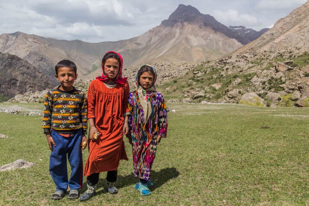
It’s a beautiful part of guesthouse culture staying with Tajik families
Among the government advice came warnings about low-level robberies in Dushanbe. I never experienced anything like this, nor did I feel on edge when walking at night.
Something I’d like to mention is that I’ve been in way more danger in the streets of some UK/European cities. I’d recommend just being more street-wise incase of pick-pockets in the markets and be careful walking around walking on your own late at night, just like you would in any capital city.
Prior to my trip, I read a lot about E-visa problems when arriving at border control at Dushanbe. I spoke to some mountain guides about this and it’s really important to have all of your documents printed out with plenty of spares. Never give your passport out or pay any fines.
Always have the contact of your travel operator or first place of your stay to hand.
Need Travel Insurance for Central Asia? I use and highly recommend HeyMondo Travel Insurance. As a reader of Journal of Nomads, you get a 5% discount of your insurance plan!

14.1 Illness
An important part of safety is keeping healthy while you’re hiking in Tajikistan. I picked up a violent stomach bug on the plane to Osh (most likely from England!) and had explosive diarrhoea for several days. It was not pretty.
This combined with Acute Mountain Sickness (AMS) made me really quite poorly for a few days. I couldn’t eat a single thing, I was struggling to keep hydrated and I was really weak. I rested and after a few days, I gradually felt better.
A huge part of hiking in Tajikistan is checking in with yourself. How are you really feeling? Pushing through a day to get to the mountain may not be a great idea if you’re not 100%. Make sure you have a back-up plan and let someone know this too.

When thundering AMS hit me (yep, that’s me in the balaclava)
Please ensure you have a solid first aid kit (scroll down to WHAT TO PACK FOR HIKING IN TAJIKISTAN). Also prepare for traveller’s tum because Western stomachs aren’t very strong.
Tajikistan’s mountains have intense elevation, you can experience anything from 2,000m to 5000m+. Acute mountain sickness is common here. You’ll likely get a small headache and you can take Diamox to help with symptoms.
If you start feeling dizzy, have loss of balance or confusion, or struggle to stay awake, you must tell someone or go to a lower altitude immediately.

14.2 Assess risk of activities
Due to lack of emergency help in the remote places, you really need to assess the risk of what you’re doing. Something you’d be quite comfortable doing back home with an easy possibility of rescue is very different to being in somewhere like the Pamir Mountains.
For example… Descending steep scree on a mountain back home may feel trivial, so you try it in on a remote peak in the stunning Jizeu Valley. Someone shouts: ‘look up, there’s a GOLDEN EAGLE whizzing past your head!’ And the next thing you know, you’re on your back and you’ve broken your ankle. Help isn’t coming for days 😛
Take it easy. If something is telling you you’re out of your comfort zone, listen to that voice.
Also, get comprehensive insurance that covers you at high altitude. For hiking upto 5,000m, I recommend HeyMondo.
Need Travel Insurance for Central Asia? I use and highly recommend HeyMondo Travel Insurance. As a reader of Journal of Nomads, you get a 5% discount of your insurance plan!
14.3 Is Tajikistan safe for a woman?
In my time travelling across Tajikistan, I want to reiterate I was treated only with warmth and generosity.
There was one incident at an Afghan market however that I do need to mention. We explored a small market close to the border with Afghanistan in the Wakhan Valley, which has far stricter rights for women.
Me, along with many other women in the group, were quickly surrounded by a lot of men. Most of them were stall owners, keen to sell their wares.
This felt similar to being in the souks in somewhere like Marrakech. The market was bustling with energy and noise which could be pretty intimidating for some people, especially given as it was only men.
We learned afterwards that one of the women in our group, who was dressed head-to-toe in respectful clothing, was inappropriately touched by one of the men. She was obviously really upset by what happened and our guides were horrified to hear about it.
So as a woman, I’d say you do have to exercise a certain degree of caution in some places. Cruelly, misogyny is still so prevalent everywhere in the world and sadly so much of being a woman is having to be on guard.
If you’re staying in a hostel, try and book a room for yourself. Homestays will always ensure that men and women stay separately but it’s always good to check.
In the more remote areas and also places which have stricter religious ideals, I would be slightly more vigilant, but not necessarily more concerned for your safety.
Another point is that you must dress appropriately, especially while in remote villages on the Pamir Highway. Please read further to what to wear in Tajikistan.

In many of the remote parts, it’s good to wear clothing that covers shoulders and knees
A great deal of countries in the world have Western influences so many visitors can fall into the habit of applying these ideals and expectations to remote places.
Tajikistan is a predominately Muslim country, it’s so important to respect this.
If you’ve never been to any of the ‘stans before, travel advice can be overwhelming so it’s important to speak to people who have actually been there and talk through your concerns.
I’m happy to answer any queries or concerns so please get in touch if you want to chat. I found this blog by Adventuresoflilnicki to be an honest and helpful insight about her experiences.
14.4 Is Tajikistan safe as an LGTBQ+ person?
According to the UK’s government travel advice, same-sex sexual activity is not illegal under Tajik law.
However, local attitudes are conservative and the levels of tolerance and acceptance in society may vary, particularly outside the main cities. It would be wise to take care when showing affection in public.

15) 6 best hikes to explore in Tajikistan
I have the full GPX files which you can export to any navigation app. If you’d like them, please contact us!
- Jizeu Village, Bartang Valley: 15km out-and-back, +750m -750m, easy-moderate
- Panoramic Ridge, Kargush: 5km out-and-back, +450m -450m, easy
- Engels Peak Meadows, Wakhan Valley: 20km out-and-back, easy-moderate
- Ortoboz Pass, Murghab district: 11km out-and-back, +850m -850m, challenging
- Artuch to Mutnye Lake, Fann Mountains: 57.4km, out-and-back 3-day trek, +3,150m -1,430m moderate-challenging
- Seven Lakes, Fann Mountains: 15km out-and-back, +800m, moderate
1) Jizeu Village, Bartang Valley
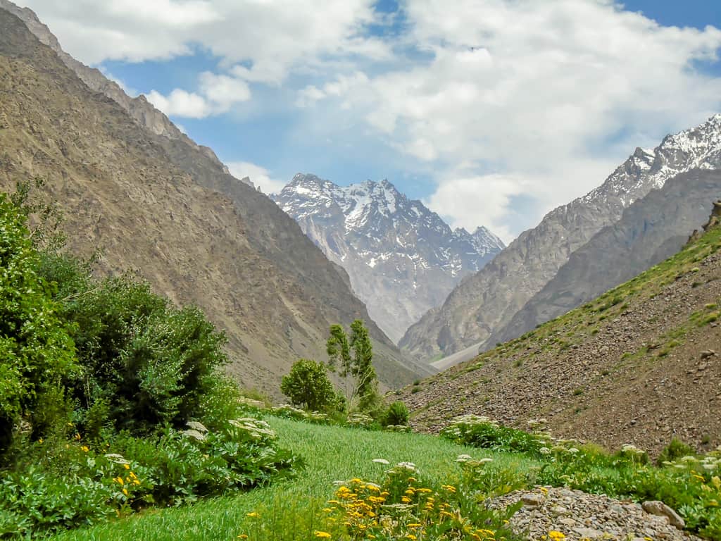
Distance: 15km out-and-back
Elevation: +750m -750m
Starting elevation: 2,080m
Difficulty: easy-moderate
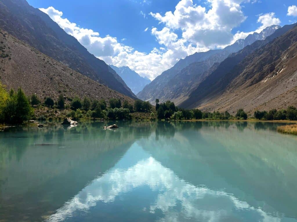
Jizeu village, a tiny hamlet nestled in the Bartang Valley about 30km east of Rushan, is one of Tajikistan’s hidden treasures. This area really felt like an oasis and I’m so glad to share it with you.
With jagged mountains plunging into crystal blue waters, this valley is so serene. There is plenty of shrubbery and trees too, which provide perfect spots to sit and rest.
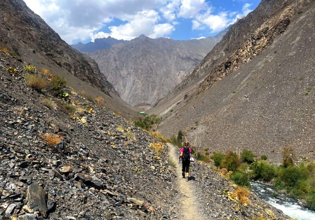
About 12 families live in these mountains, most of whom kindly offer up their homes as guesthouses.
I’d really recommend you give yourself a few days to explore Jizeu, which is accessible through an easy hike (7km one way) from the suspension bridge at Bartang River.
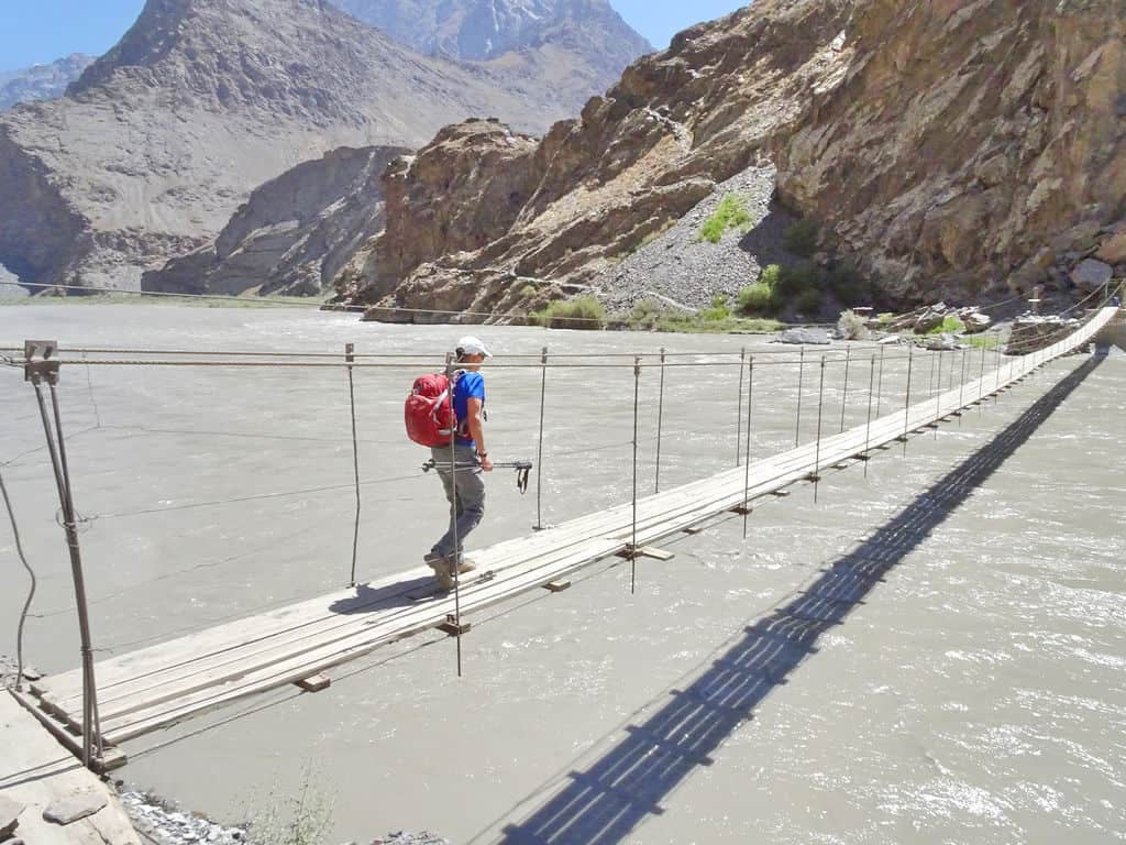
Head south-east on the obvious track, you’ll pass roaring glacial tributaries and spectacular scenery.
Jizeu is split into upper and lower Jizeu. Once you arrive, you’ll see hundreds of apricot trees, and mesmerizing lakes fed by the Jizeudarya River.
2) Panoramic Ridge, Kargush
Distance: 5km out-and-back
Elevation: 450m -450m
Starting elevation: 4,310m
Difficulty: easy

The drive through Khargush immerses you in the high plains and Martian landscapes of southern Tajikistan. The horizon is illustrated with hundreds of the Pamir peaks and it’s a really unique part of the country that not many people get to experience.
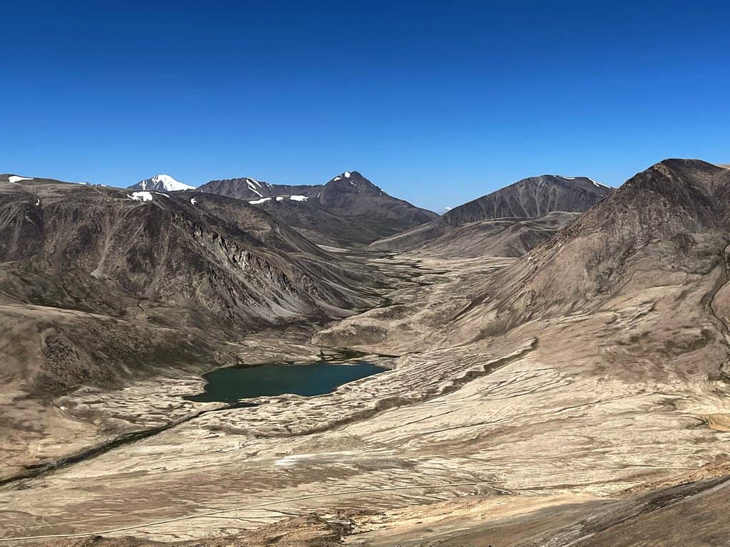
Head east up a simple track up to a wide shoulder, and then head south. You’ll see sweeping views of so many mountain ranges, along with Khargush lake.
The hike is not technically challenging whatsoever, but the altitude will add a level of difficulty and you should regularly check in with yourself.
The altitude is pretty high here (starting at 4,130m), combined with a steep track and no shade. Tackle this hike slowly, keep hydrated and keep your head covered.
3) Engels Peak, Wakhan Valley
Distance: 20km
Elevation: +750m -750m
Starting elevation: 3,250m
Difficulty: easy

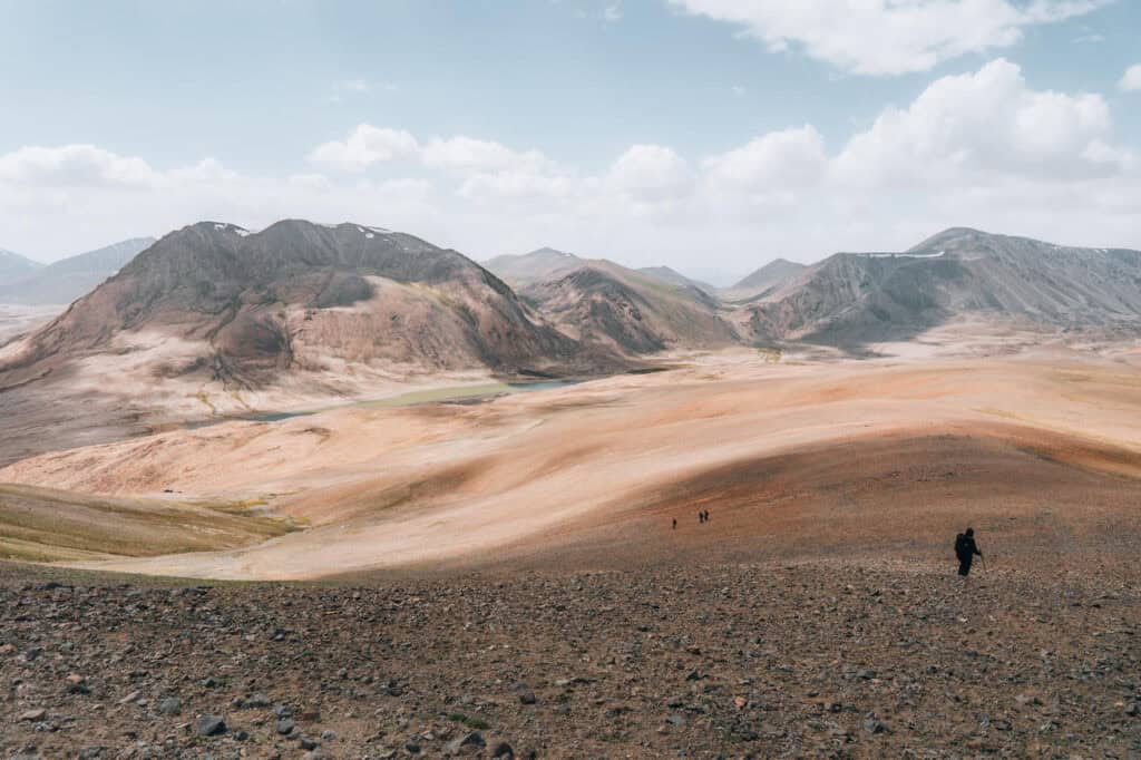
This is a pleasant hike following the Kishtijarob River, meandering up to its glacial source from the striking Engels Peak.
Technically, this is an easy walk because the ascent is spread generously over 10km. There are also plenty of spots to sit by and rest – although there’s very little shade!
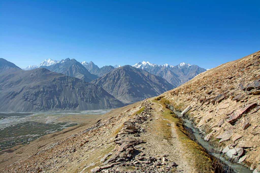
As you begin from just above Langar, the route offers sweeping views over the vast Wakhan Valley, the Panj River, Afghanistan and far over to Pakistan’s Hindu Kush Himalaya.
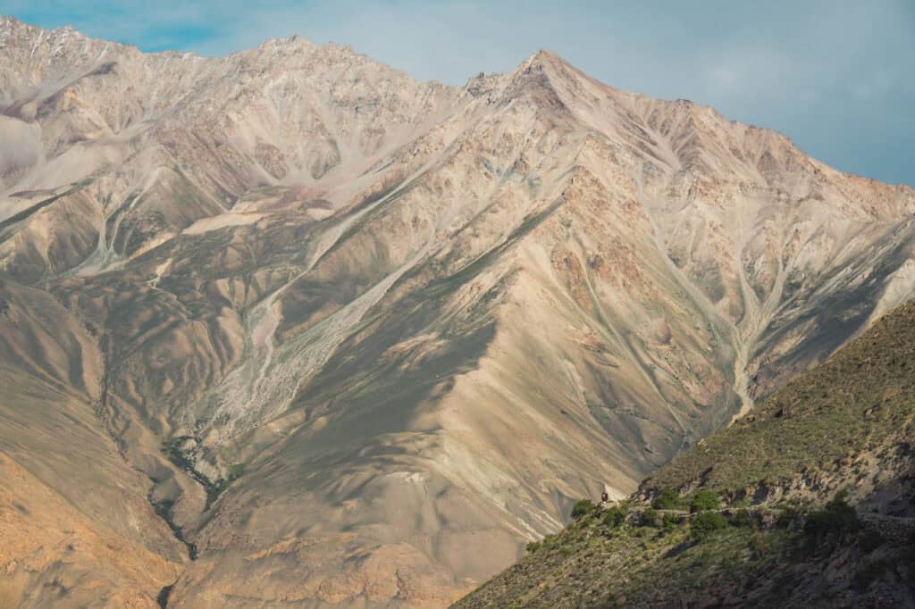
As you head north-west into the valley, you’ll see impressive geological formations, revealing layers of compressed time in the rock. Farmers who rear cows by Kishtijarob River will most likely greet you and offer you kurut (Tajik cheese).
In summer, I’d recommend setting off as earlier as you can, because this valley heats up pretty quickly and there’s no shade about.
4) Ortoboz Pass, Murgab District
Distance: 11km out-and-back
Elevation: +850m -850m
Starting elevation: 4,150m
Difficulty: challenging
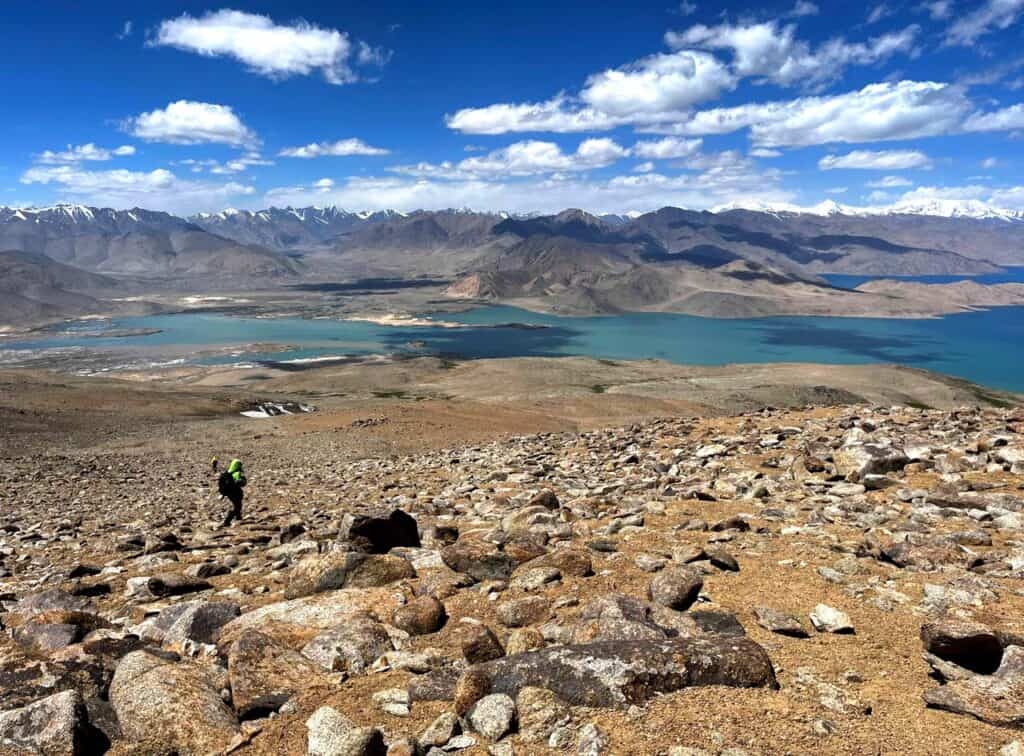
Looking down over the infinite waters of Karakul
The walk up to Ortoboz Pass is a taster of Tajikistan’s own vast tundra. Snow leopards, marco polo sheep and wild shrubbery characterise the Murghab district and the pass offers an immense view over Tajikistan’s largest lake, Karakul.
You’ll head up onto grassy plains, with sweeping vistas of the GBAO district. This place is phenomenally remote so take in the moment.
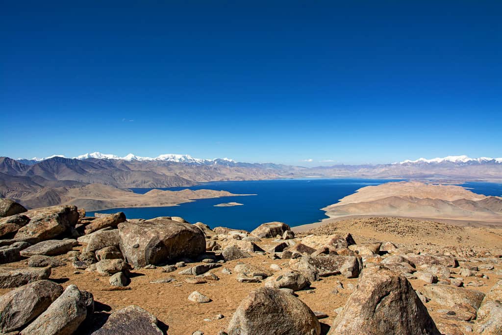
Starting at 4,150m, this is challenging and you’ll likely be affected by the altitude in some way. Technically, it’s not a difficult route. Just before the summit, there are many boulders to pick your way over but just take it really slowly and you’ll be fine.
The steeper ground commands patience, especially with the altitude, so it’s really important that you ascend incredibly slowly. Keep checking in with yourself (and others!) as you head for 5,041m at the top of the pass.
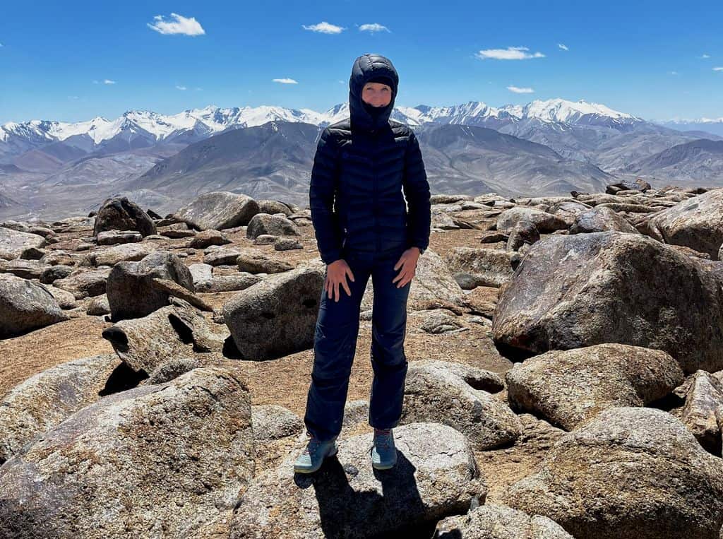
On the plateau of Ortoboz Pass at 5,041m
Do not mess about if you start feeling dizzy/unable to walk in a straight line/unable to drink or eat/have a splitting headache. Immediately tell someone and get yourself to lower elevation as quick as you can. Please read up to ILLNESS for more information.
When I walked up in early August, it was perfect conditions and there was only small patches of snow. Our guide told us that in mid July there was a lot of snowfall, so you may need to think about bringing some micro spikes. It was not steep enough to warrant crampons/axe even if there was snow.
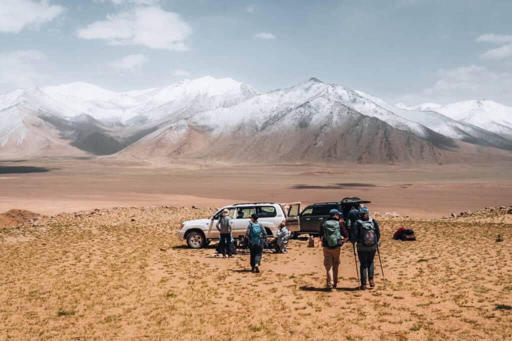
5) Artuch to Mutnye Lake, Fann Mountains
DAY ONE – Artuch to Kulikalon Lake
Distance: 13km
Elevation: +1,300m -300m
Starting elevation: 1,850m
Difficulty: moderate-challenging
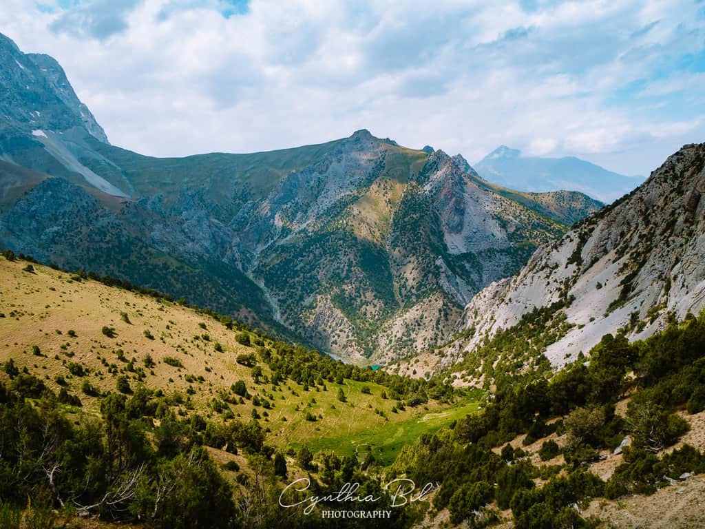
The Fann Mountains is the highest part of the Zarafshan Range and the Gissar Ranges. If you’re unsure about where to start for hiking in Tajikistan, start your inspiration with the Fann Mountains. Logistically, this range is way easier to get to than somewhere in the Pamirs and there are more tours/transport running here.

If you’re wanting to do a thru-hike or a multi-day wild camp, I’d recommend staying in a guesthouse in Artuch the night before to break up the drive from Dushanbe.
From Artuch, start on a track which winds up through a leafy luscious valley before crossing over a small stream. The ascent is slow but ramps up as you progress.
The route is easy to follow, as many shepherds and other hikers have forged a path. To the left, you’ll see a tumbling glacial stream.
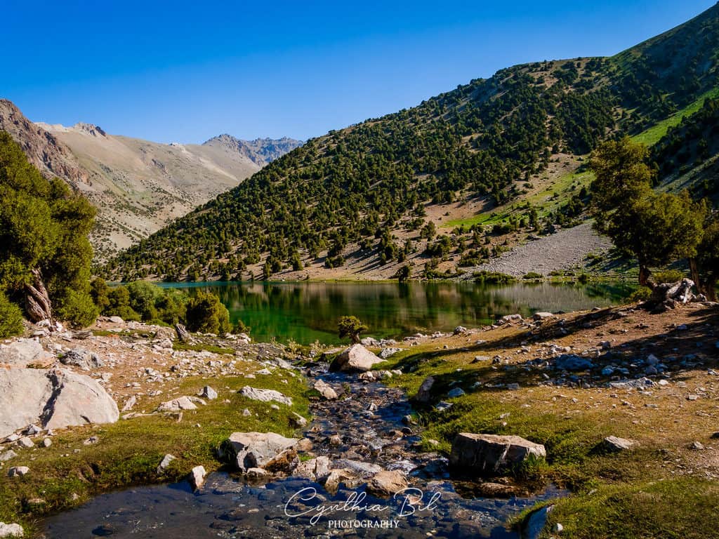
The final steep push is up a rocky path before reaching a grassy plateau.
Once you reach Kuli Kalon lake, you can relax. Take your time to explore the lakes and area – it’s phenomenal! There are hundreds of stunning camp spots for you to take your pick here.
Tip! Start the route early. Because of the lower elevation, it is hotter and the final push up to Kuli Kalon Lake does not have any shade.

DAY TWO – Kuli Kalon lake to Alauddin Lake
Distance: 10.5km
Elevation: +1,100m -1,080m
Starting elevation: 2,840m
Difficulty: moderate
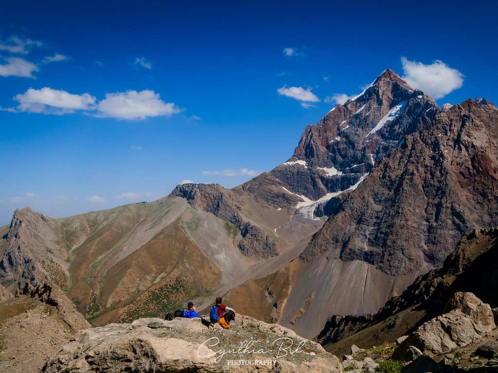
Head east and make the climb up to Alauddin Pass. You’ll get some staggering views of the jagged peaks towering over Chimtarga Lake.
There are hundreds of juniper trees which are celebrated because of their ecological importance. Due to excessive logging, juniper forests in Tajikistan are seriously threatened.
The ascent doesn’t relent until you reach the pass, and the valley heats up quickly so you’ll likely want to get up before 11am.
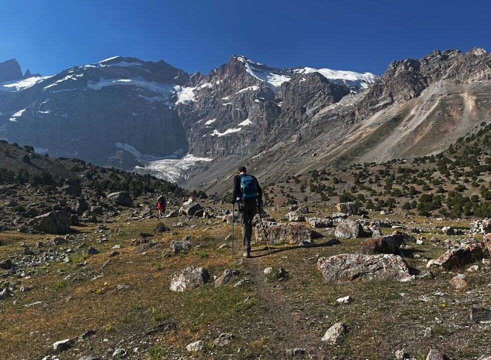
Setting off from the camp spot near the spectacular Kuli Kalon Lake
The pass itself gifts you with glimpses of the azure lakes where you’ll next be heading. You’ll also pass striking layers of strata in huge slabs of rock in the cliffs before descending down to more stunning lakes.
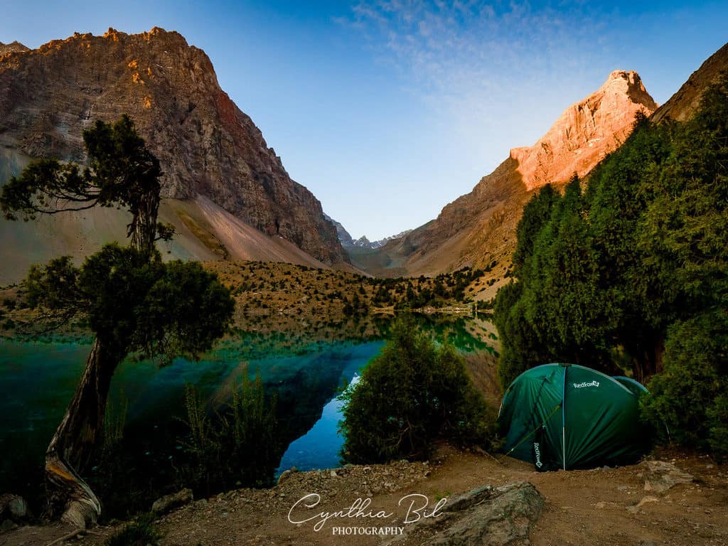
DAY THREE – Alauddin Lake to Mutnye Lake
Distance: 5.2km
Elevation: +750m -50m
Starting elevation: 2,800m
Difficulty: moderate
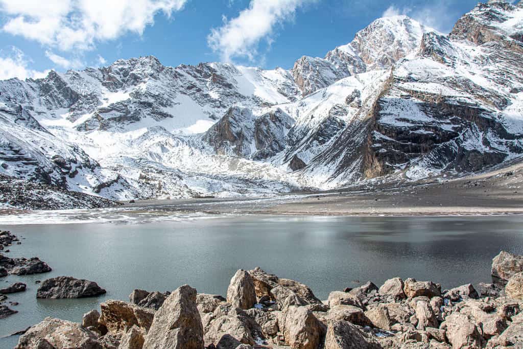
You’re definitely in alpine territory now! This route was one of my favourites in Tajikistan for its rocky ridges and metamorphosed limestone faces.
You’ll snake through a giant boulder field (it’s a climbers’ haven!) and wind inbetween many impressive buttresses.
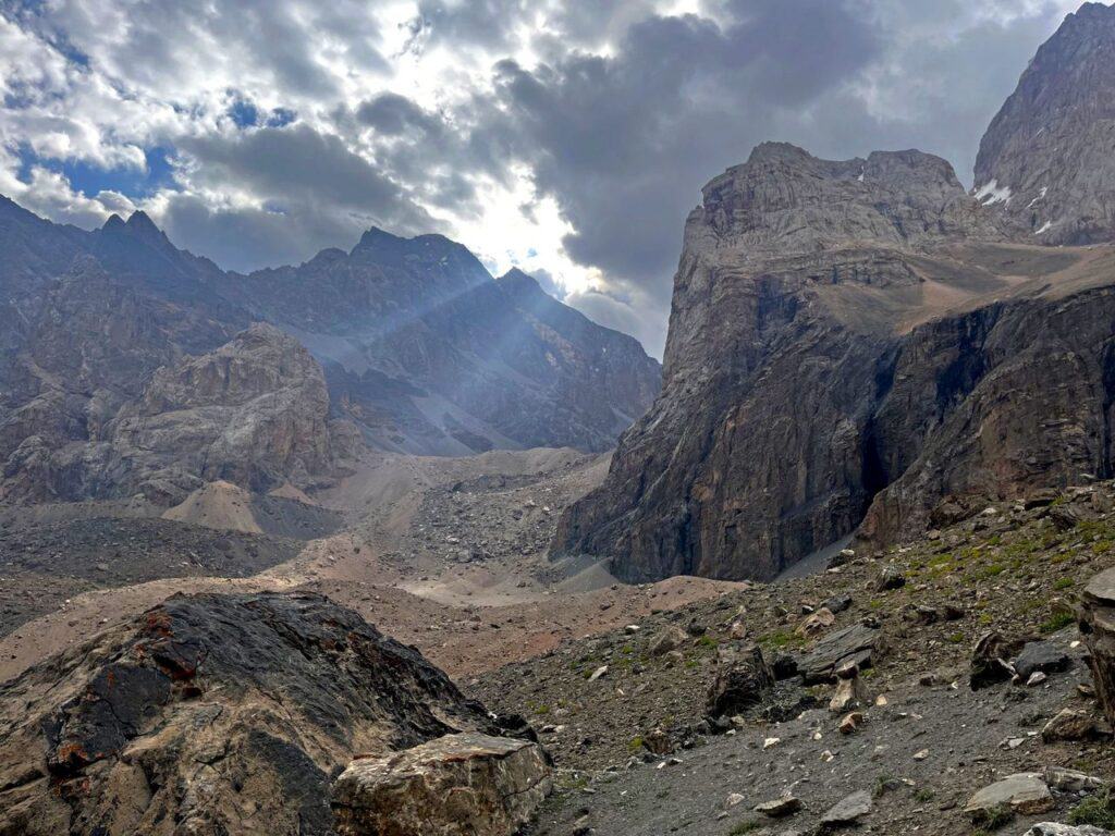
There is a lot of walking on scree and some technical steep ground just before Mutnye Lake, so if you’re not comfortable with this, definitely think about getting some practice in before your trip. If there is snow, it will definately be ice axe/crampon territory.
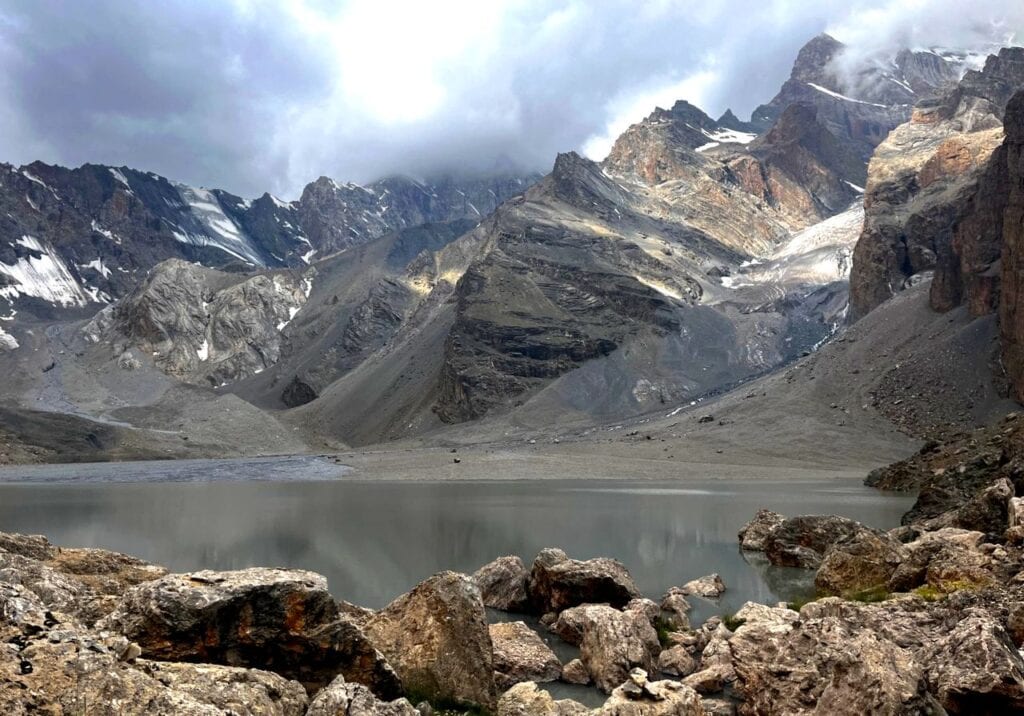
The spectacular Mutnye Lake
As a further note to this, you can continue up to Chimtarga Pass and do the Chimtarga Pass trek. This does require a level of experience with steeper ground and knowledge of using crampons/ice axe.
This blog by Talaki.org has a lot of helpful information here. I’m hoping to do this trek later this year so stay tuned 😉
6) Seven Lakes, Fann Mountains
Distance: 10km one way
Elevation: +802m
Starting elevation: 1,598m
Difficulty: moderate
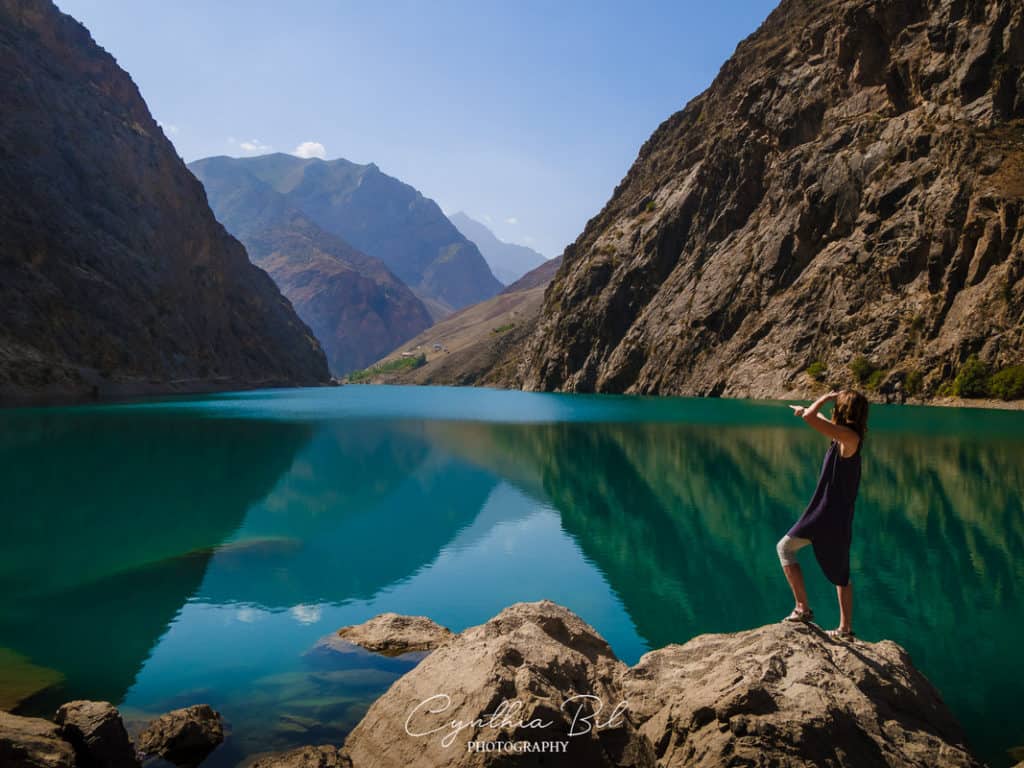
JoN’s founder Cynthia went to check out the Seven Lakes hike in 2019. She had a total blast (you can tell from her photos!) and has written a really helpful guide about how to do it here.
The Seven Lakes in the Fann Mountains are also referred to as the Marguzor Lakes or Haft Kul. Haft Kul literally means Seven Lakes in Tajik.

The Seven Lakes are a series of glacial-melt lakes that form a chain along a narrow windy road in a rocky valley. Each lake has a different name, shape and color and they are all connected by the Shing River.
The name of the lakes are as follows: Mijgon (lake #1) – Soya (lake #2) – Gusbor (lake #3) – Nofin (lake #4) – Khurdak (lake #5) – Marguzor (lake #6) – Hazorchazma (lake #7).

EXTRA: The Pamir Trail
I mentioned the Pamir Trail before, but if you’re wanting an impressive challenge then take a look at this 1,297km route (with a whopping 63,350m of ascent!) traversing eastern to western Tajikistan.
There is lots of helpful information listed on their website, including GPX files of each stage… so even if you don’t fancy doing the lot you could follow parts of it and create your own adventure.
Some sections require careful technical approaches, with the aids of crampons/walking axes on glacier terrain, so it does require a level of mountaineering experience.
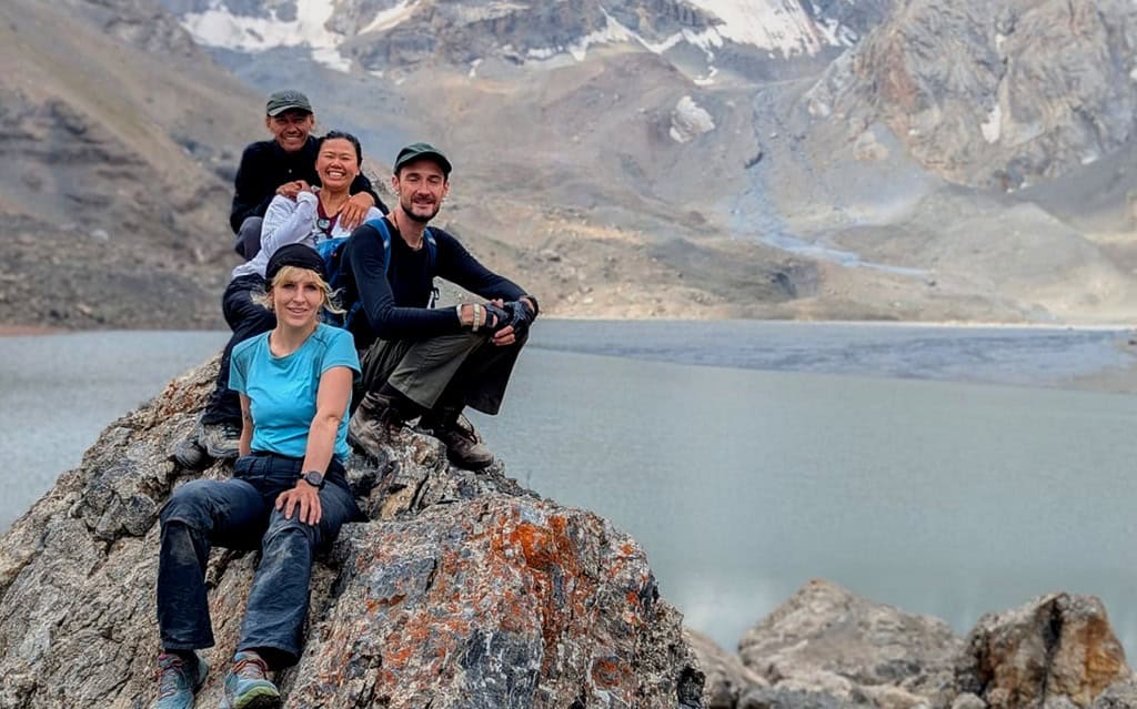
Hopefully this guide to hiking in Tajikistan covers all of your questions and helps you with planning your trip. Tajikistan is an enchanting place and we’re thrilled to share what we’ve learned with you. If you have any other queries or insights, please comment below or contact us!
related Posts

Tajikistan food: 10 delicious dishes and Central Asian delicacies to try

13 Best Things to do in Dushanbe: A complete City Guide
Is Tajikistan safe to travel in 2026? 18 Useful Things to Know before you go
How to travel the Pamir Highway in Tajikistan: a Complete Guide

Best Tips and complete Packing List for Traveling in Central Asia in 2026 – When to go and what to wear when visiting Central Asia
